The Lakes • Roscommon County, Michigan • Surveyed
Higgins Lake
130 ftDeepest, as Michigan DNR, IFR lake deep points publishes it, read on its page 18 October 2026
130 ftThe deepest contour in Michigan DNR's survey, drawn every 10 ft
Every contour on the print is a line the state's surveyors drew; nothing between them is guessed. Pin your dock in the studio and it prints under the name your family uses.
What arrives: the print you set up, drawn at the size you choose, shipped flat or rolled by the printer, or a file the same day for the digital edition.
Three of the Nine Styles
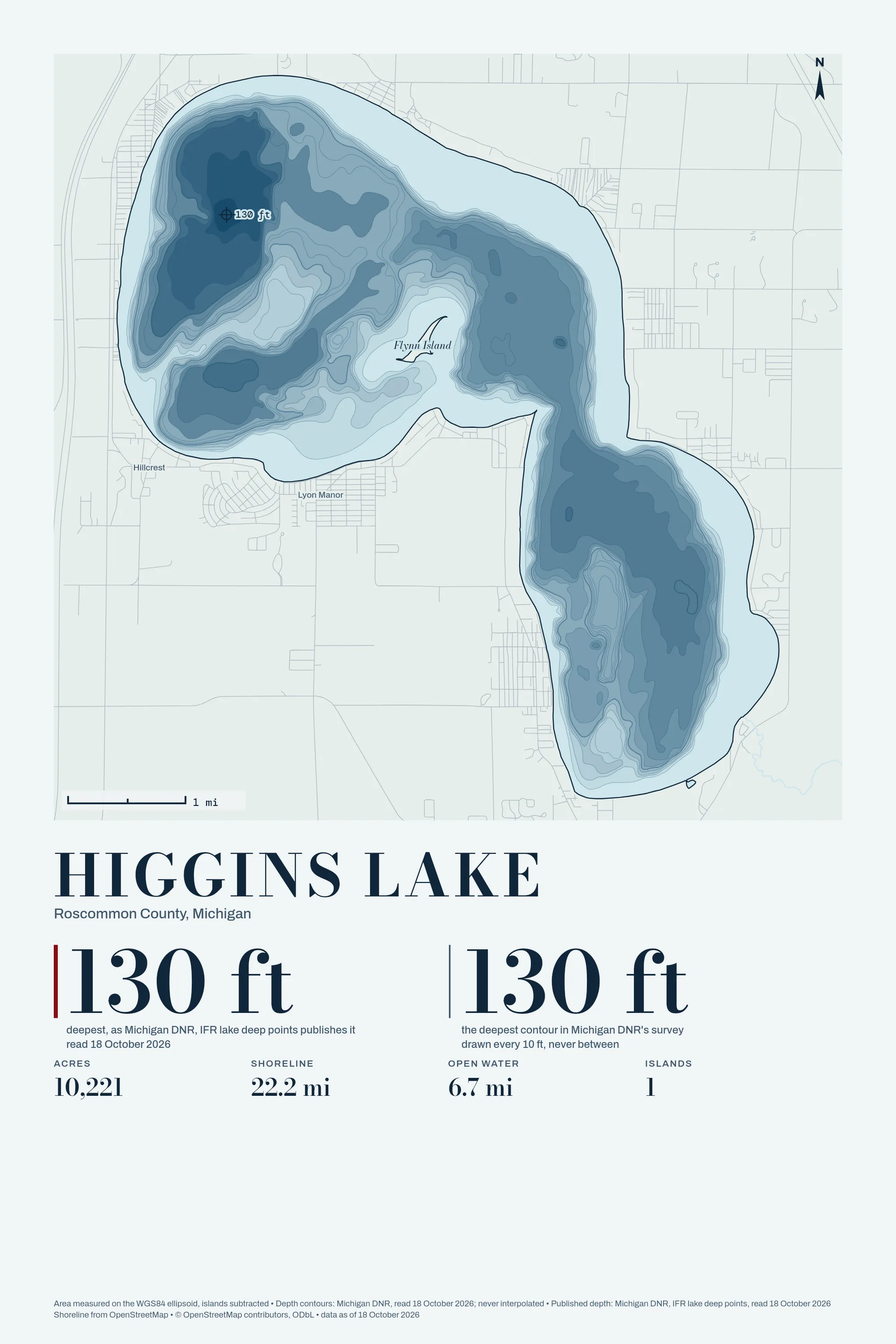
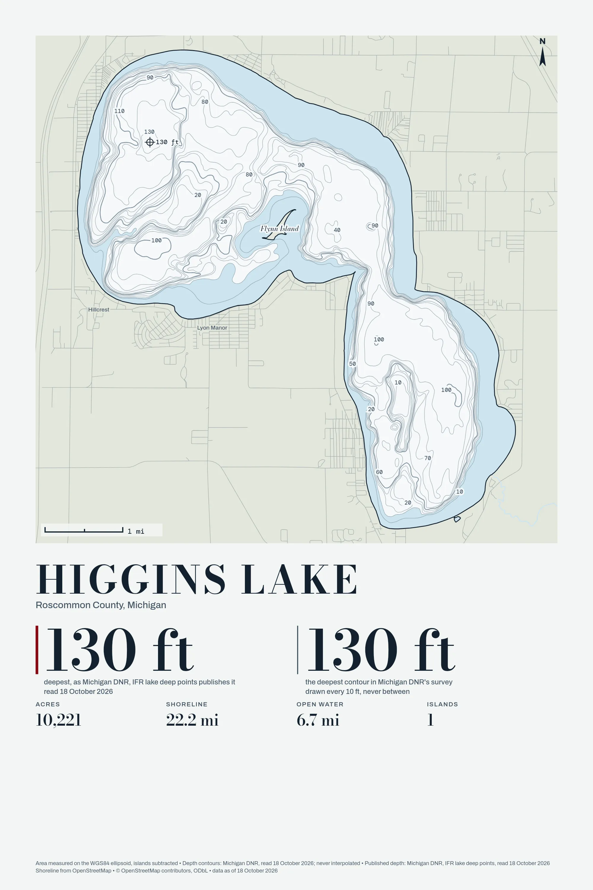
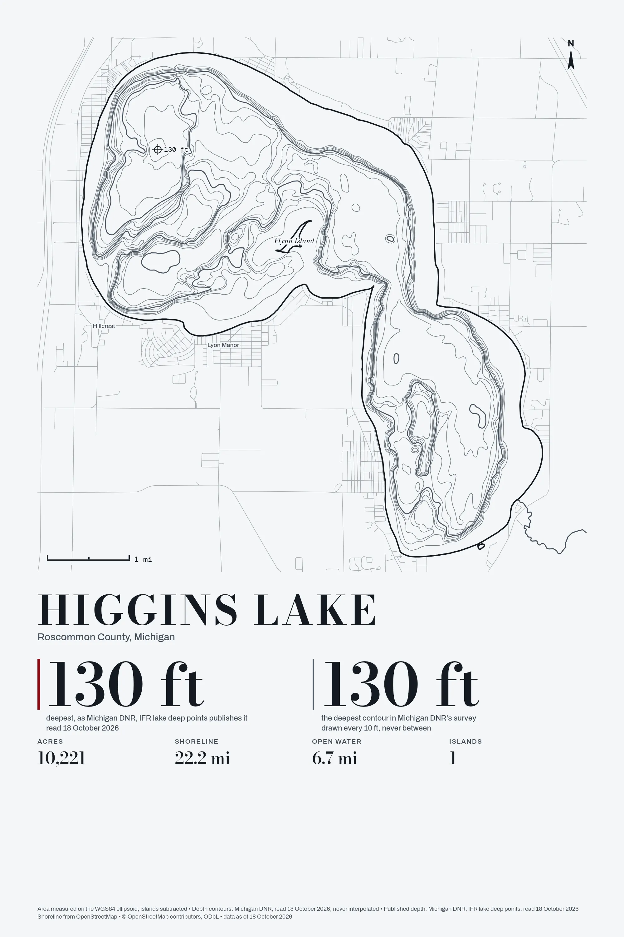
The figures
| Water | 10,187.14 acres published, 10,221 acres measured |
|---|---|
| Shoreline | 22.2 mi, islands included |
| Longest open water | 6.7 mi |
| Islands | 1 |
| Depth survey | Michigan DNR, read 18 October 2026 |
Where each figure comes from
- shoreline, OpenStreetMap via Overpass: www.openstreetmap.org, read 18 October 2026
- depth contours, Michigan DNR: services3.arcgis.com, read 18 October 2026
- published, quoted: MaxDepth: 130: services3.arcgis.com, read 18 October 2026
- published, quoted: Acres: 10,187.14: services3.arcgis.com, read 18 October 2026
Not affiliated with or endorsed by any state agency, lake association or realtor; no logos on any print. The drawing is ours, made from the OpenStreetMap shoreline as of 18 October 2026 (© OpenStreetMap contributors. Open Database License 1.0: https://www.openstreetmap.org/copyright).